Superintendents and field managers need to hold a mental map of their property in their heads. They know which spots are first to wilt, where disease pressure is highest, and the locations of perennial pests requiring preventative treatment. Those observations are then used to target applications of water, fertilizer, or pesticide. It is difficult to maintain this institutional knowledge, and harder to communicate it with crew members operating a sprayer or scheduling irrigation. Today, the team at GreenKeeper has revolutionized this task with the launch of GreenKeeper CIS.
TAKE CONTROL OF YOUR APPLICATIONS
GPS-enable sprayer technology has dramatically improved turf management efficiency. This equipment minimizes overspray, precisely targets pests, and can even adjust product and fertilizer application rate on the fly. The turf at Ager Jr GC has been managed with a variable rate sprayer (VRT) from Frost, Inc. during the past six years. The retrofitted Toro MultiPro precisely applys PGRs to the greens with minimal overspray on the collars and rough. This has significantly reduced collar decline from PGR over-regulation and has reduced the required spray volume by 20% on greens and tees and by 12-15% on fairways. While the hardware is capable, the software to control the sprayer has been lacking. That’s where GreenKeeper CIS is here to help.
ADJUST COURSE BOUNDARIES with ease
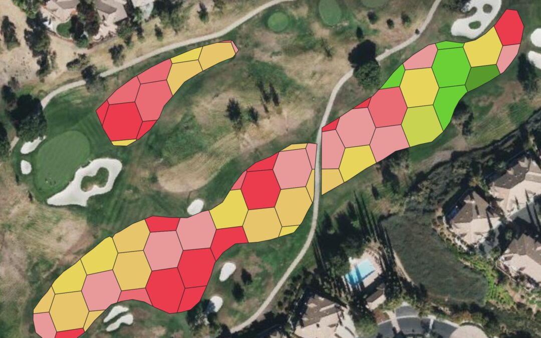
While VRT technology has been impressive, existing software solutions to edit course boundaries, draw pests, and export prescription maps have been difficult to use. Most were highly complex, not intuitive and required extensive GIS experience to operate. With GreenKeeper CIS, users can easily add and edit boundaries to precisely control applications. The software automatically crops boundaries within other boundaries. Create a prescription map to only treat fairways and approaches and GreenKeeper CIS will remove greens and bunkers within that fairway boundary. The prescription sprayer maps are then linked directly to the sprayer configurations stored in GreenKeeper.
LOG PEST OUTBREAKS WITH CIS
Users don’t need a VRT sprayer to benefit from the data display capabilities within CIS. Draw a shape and CIS will calculate the size of the area. See a pest while driving around the course? Use your phone to log the locations and attach pictures for future reference. Convert these locations into a prescription map and mark the pest as “Controlled” in GreenKeeper. This feature is also powerful when trying to control perennial pests like root diseases or weeds like yellow nutsedge. At Ager GC, we have moved to a targeted approach for Pythium root rot, nutsedge, and goose and crabgrass post emergence. This has saved time and significantly reduced product costs. It also minimizes potential widespread phytotoxicity from some herbicides.
AUTOMATE DATA COLLECTION AND DISPLAY
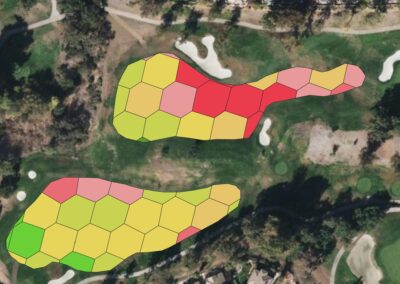
GreenKeeper CIS is designed to integrate with different sensor technologies. Mowed-mounted crop sensors measurements, drone imagery, weather station networks and soil moisture sensor data can stream automatically into GreenKeeper CIS. These data can add context to help direct management. The Holland Scientific sensors offered through GreenKeeper use an active light source to measure plant health, density and color with every mower pass. Those data can then be turned into prescription fertilizer maps or provide direction when adjusting run times of an irrigation system.
Realize the power of precision with GreenKeeper CIS
GreenKeeper CIS will revolutionize precision turfgrass management. It links observations with advanced modeling and GPS sprayer prescription map generation to simply turf management. Save time and money by targeting pests and minimizing over-spray, and be confident when scheduling fertilizer, PGRs and irrigation applications.
GreenKeeper CIS is an add-on feature within GreenKeeper App. It can be accessed via the CIS icon on the main navigation menu. To learn more about GreenKeeper CIS visit GreenKeeperApp.com or upgrade your subscription on the Purchases page within GreenKeeper App.

Bill,
what’s the next step to start integrating this technology into our operation?
You can start using CIS immediately by clicking the map icon on the main navigation menu. This will ask if you want to upgrade and redirect to the Purchases page. After you have upgraded, you can click the map icon again to start mapping your course.
There are tutorial videos to help describe the process of setting up areas. You can then start exporting those GPS spray prescription maps to a USB or SD card for your sprayer as you create them.